Pt.1: Silverton to Telluride
Course Photographs by Klas Eklof, July 2006
Pt.1 | Pt.2 | Pt.3 | Pt.4 | Pt.5 | Pt.6 |
|
|
Pt.1: Silverton to Telluride Course Photographs by Klas Eklof, July 2006 Pt.1 | Pt.2 | Pt.3 | Pt.4 | Pt.5 | Pt.6 | |
|
On raceday, the course to Telluride (mile 27.8) was a mystery to me.
I brought my camera along for this first segment of the race.
All the pictures after Telluride were taken during course marking parties and training runs before the race.
|
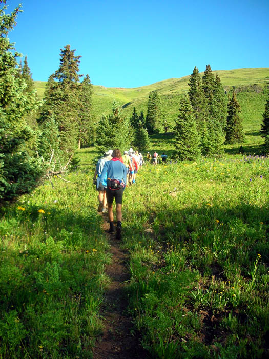
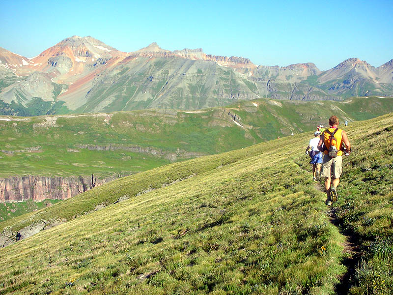
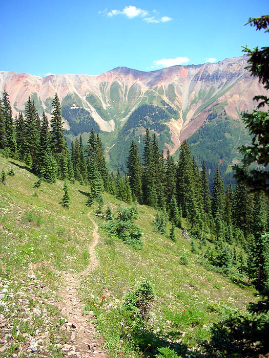
| Climbing out of Silverton Bear Creek canyon and approaching Putnam Basin. Finally at treeline after 5 miles and 2,000 feet of easy climbing from the start in Silverton. |
 |
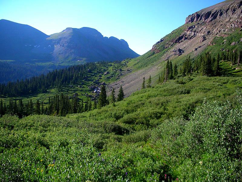
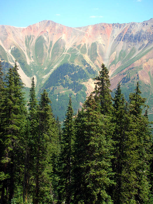
| Looking south from the base of Putnam Basin. |
 |
| Putnam Basin, with moon. The trail continues along the top edge of the cliffs and can be seen climbing to the saddle at the top left, Putnum-Lime Creek saddle [12,400']. |
 |
|
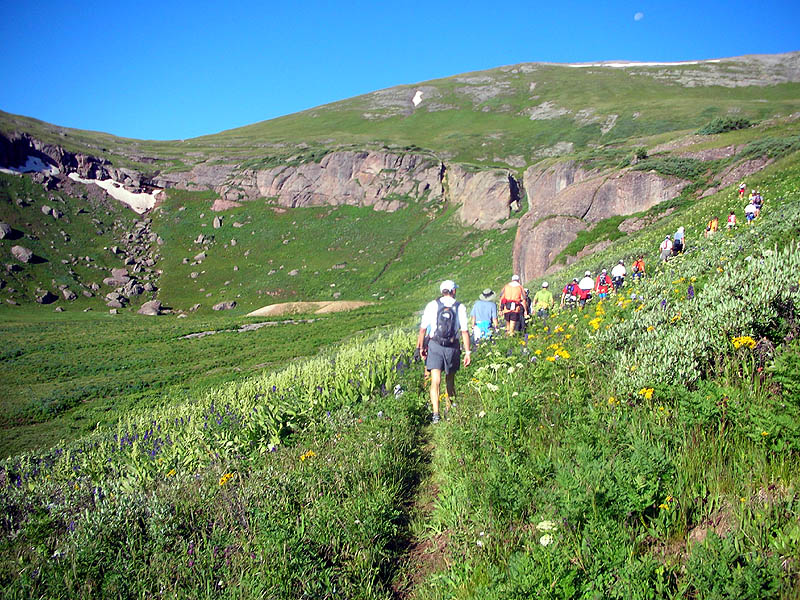
Mile 7. From Putnum-Lime Creek saddle [12,400'],
looking back down the basin into Silverton Bear Creek and directly toward the start in Silverton hidden in the valley below. The highest peak, right of center, is Sultan Mountain [13,368'] |
 |
| Contouring around the left (SW) side of Putnam-Lime ridge. Double peak at the top left is a fore-shortening of Fuller Peak [13,761'] and Vermilion Peak [13,894']. |
 |
|
Descending from Putnam-Lime ridge onto the Cataract-Lime Creek saddle,
with the cliffs of the horseshoe chasm of Cataract Gulch. The trail remains high above the cliffs and crests the low point of the nearest ridge at the snowfield at dead center, Cataract-Porcupine saddle [12,230']. |
 |
| Looking back at the Cataract-Lime Creek saddle, cliffs of Cataract Gulch on the left. |
 |
| View from the Cataract-Porcupine Saddle, looking west at one of the Twin Sisters [13,432'] |
 |
| Running down the upper meadows of Porcupine Creek, looking north. |
 |
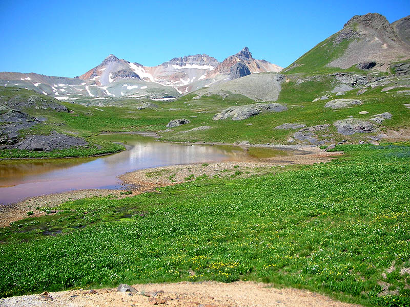
|
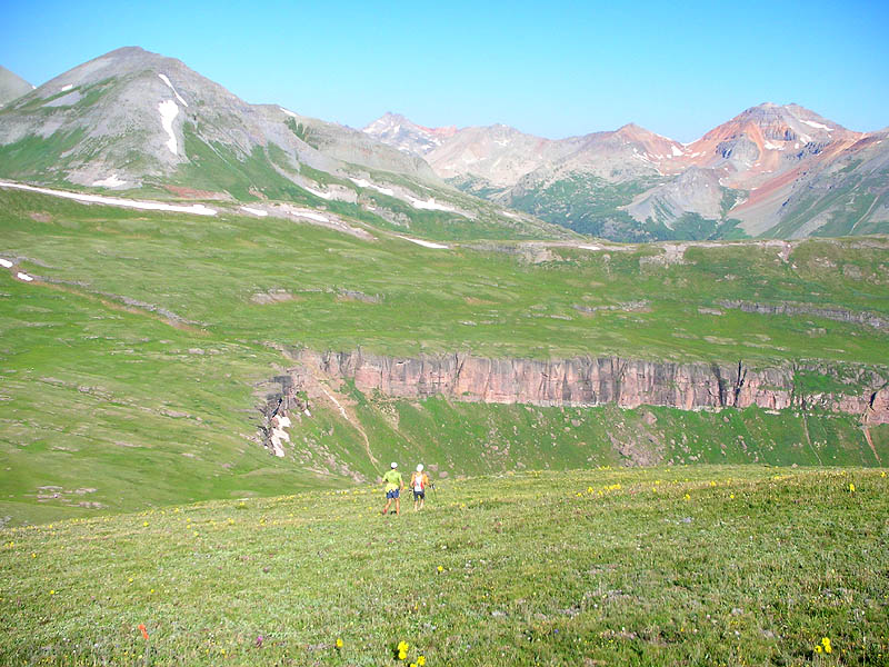
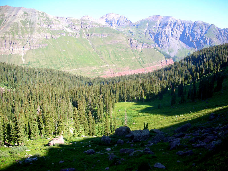
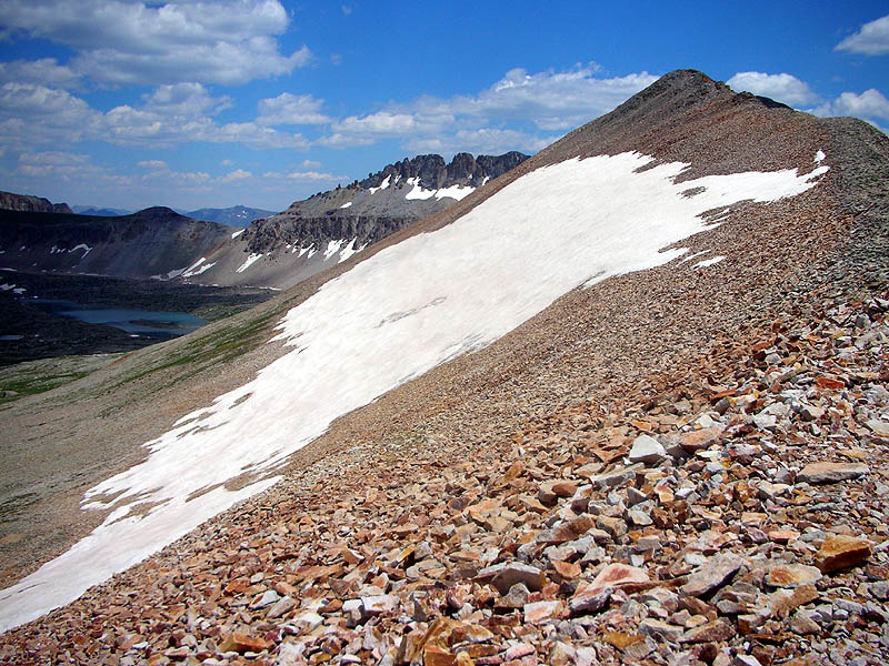
More of the upper meadows of Porcupine Creek. In the middleground, our Kamm Traverse route can be seen sloping across the clean grassy face above the red cliffs. And in the very background, the rounded peak slightly right-of-center is US Grant Peak [13,767'] and the saddle directly to it's right is Grant-Swamp pass [12,920']. Our race course reaches that pass only 6 trail miles from here. |
 |
| On the Kamm Traverse, looking downward and south. Twin Sisters at the upper left. |
 |
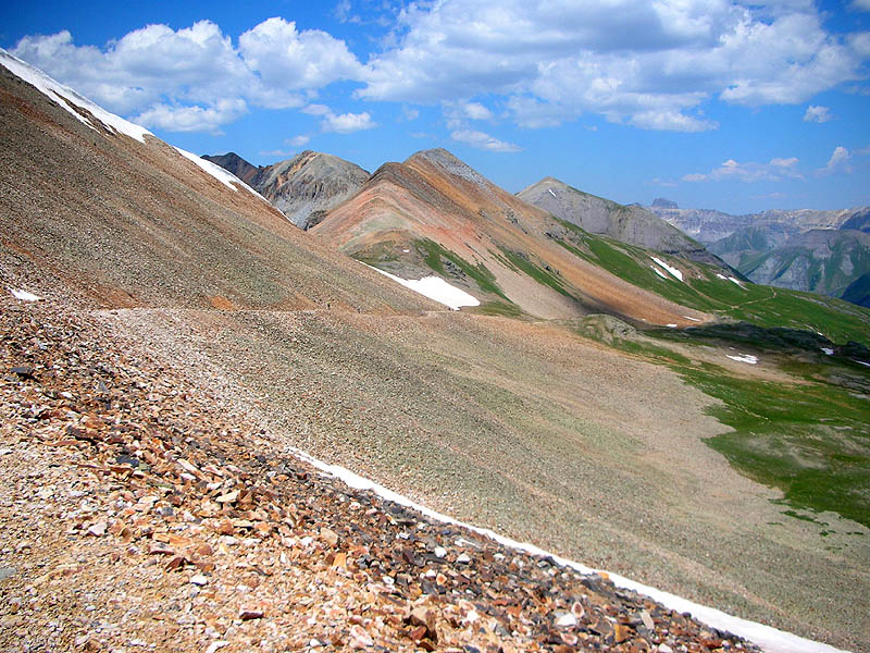
| On the Kamm Traverse, looking upward and north. Peak 13,156 is the rocky one to the left. |
 |
|
On the Kamm Traverse, looking across South Fork Mineral Creek Valley at the Porcupine Creek watershed. Note the grassy mound on the horizon right-of-center, the low point directly to it's left is the Cataract-Porcupine saddle [12,230'], which our trail crested 3.4 miles ago. |
 |
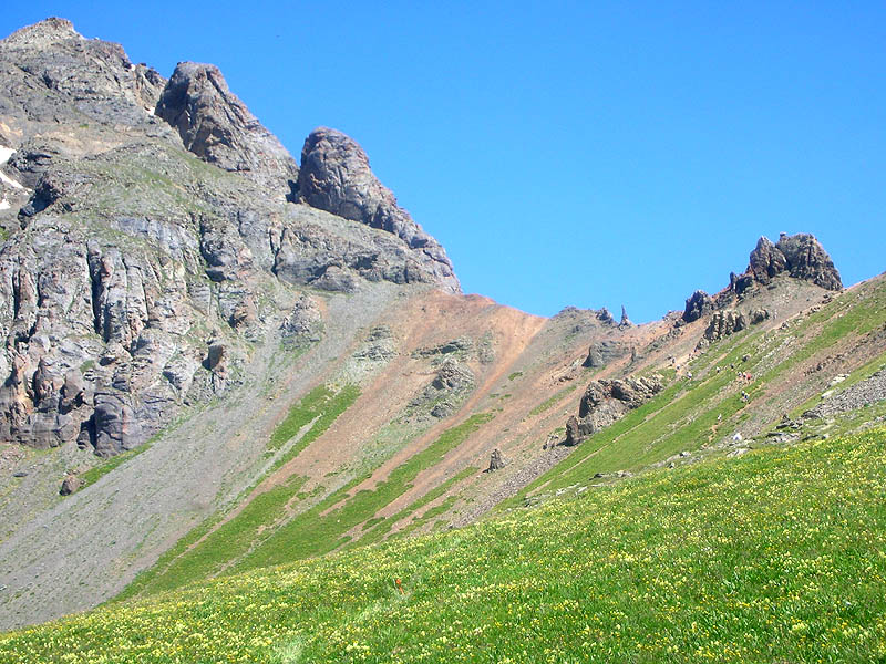
| Disappointingly, there are a few yards of level trail. Like here, near Island Lake, looking southwest into Ice Lake Basin. The central cluster of peaks are, left-to-right, Fuller Peak [13,761'], Vermilion Peak [13,894'], and Golden Horn [13,765']. |
 |
|
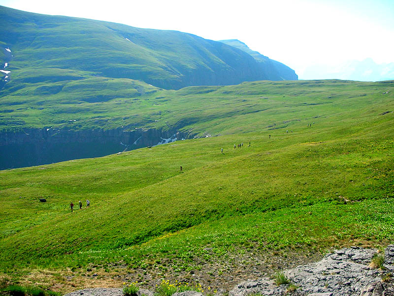
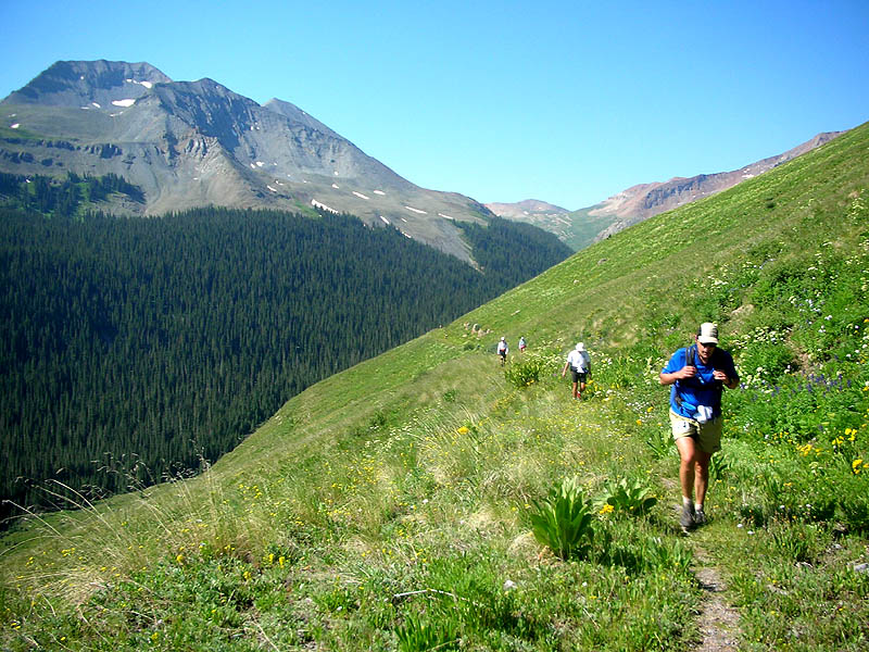
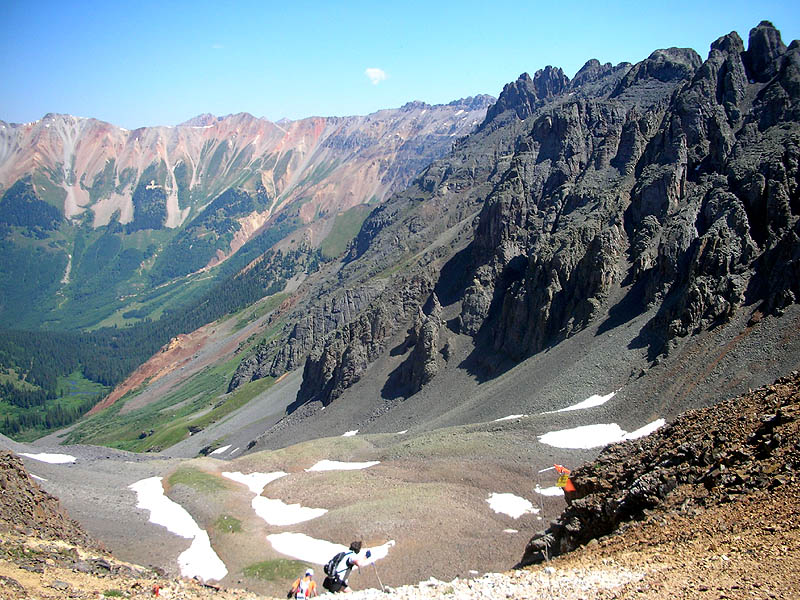
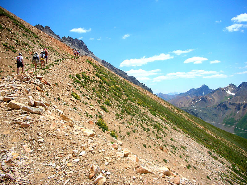
View of the final pitch of the climb up to Grant-Swamp Pass [12,920']. Note the sting of runners on the grassy slope. The pass is the low notch at the extreme right. |
 |
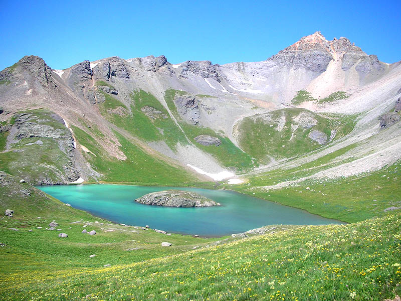
| View from the climb to Grant-Swamp Pass [12,920'], looking west at Island Lake and un-named peak.. |
 |
|
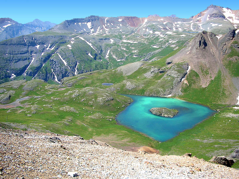
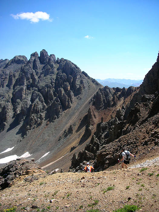
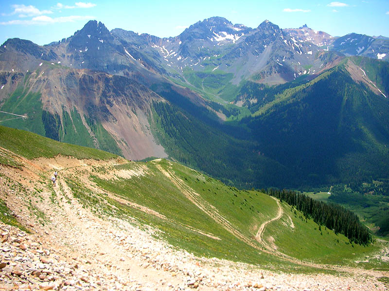
View from the top of Grant-Swamp Pass [12,920'], looking south. Fuller Lake can be seen in the extreme upper right. And note the string of runners below in the grass at the far left. |
 |
|
The other view from the top of Grant-Swamp Pass [12,920'], looking north, and the start of the very steep descent into Swamp Canyon. In the distance, the trail switchbacking up through the green and orange face is our next climb, to Oscar's Pass [13,140'], only 6.4 trail miles away. |
 |
| Grant-Swamp Pass descent. |
 |
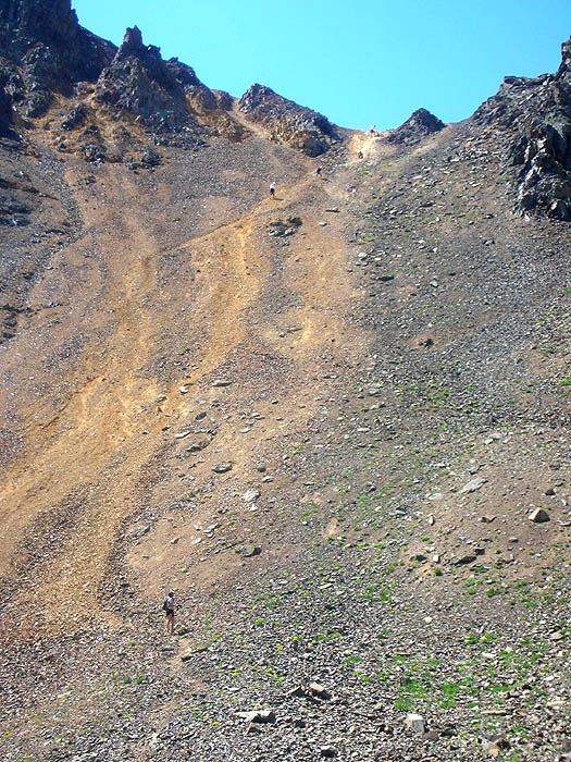
| The descent of the north face of Grant-Swamp Pass, a little slower without snow. |
 |
| Rocky trail section descending through Swamp Canyon, Flavio Dalbosco at the far right. |
 |
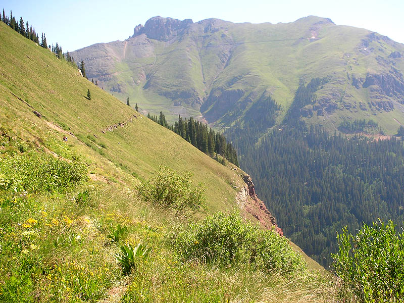
| A fast section of trail descending through Swamp Canyon, and the view of the next climb gets better, Oscar's Pass [13,140'] is the saddle at center in the shade. |
 |
| Zoom-in of the climb to Oscar's Pass [13,140']. |
 |
|
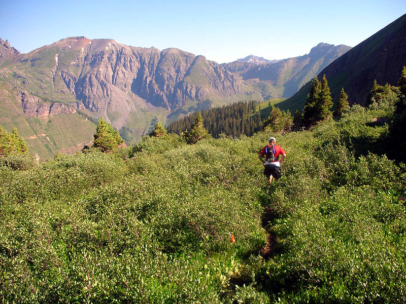
On the climb to Oscar's. Swarms of biting black flies not shown. |
 |
|
On the climb to Oscar's, looking south back into Swamp Canyon.
Grant-Swamp Pass [12,920'] is the saddle immediately left-of-center. Our trail came down the west (right) side of the canyon. The white tent of the Chapman aid station is visible in the corner of the field on the valley floor below. |
 |
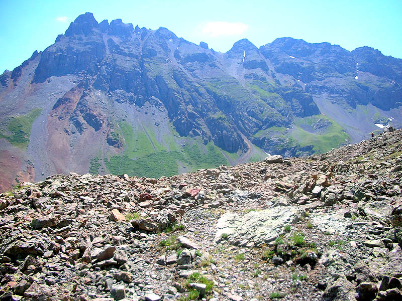
| View at the top of Oscar's Pass [13,140'], looking east into Bridal Veil Basin and Lewis Lake. |
 |
|
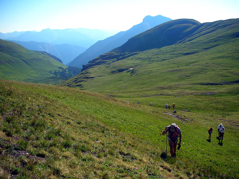
The other view at the top of Oscar's Pass, looking north at the trail towards Telluride.
At dead-center is a snowfield, which is also known as Wasatch Saddle [13,060'].
Our route climbs up the snowfield, crosses over the saddle, and then descends behind the ridge for 6.5 miles. The most distant and prominent peak, poking it's head up from way back there on the right, is the west face of Potosi Peak [13,736']. Our trail will be running directly across the base of Potosi in a short 15.7 miles. |
 |
|
|
Pt.1 | Pt.2 | Pt.3 | Pt.4 | Pt.5 | Pt.6 | |